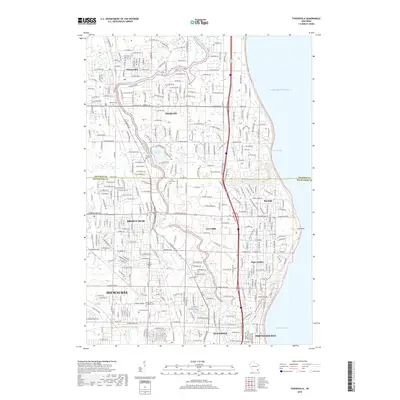
2018 Map of Thiensville
USGS Topo · Published 2018About this map
The Milwaukee River carves a winding path through this suburban corridor on the Lake Michigan shore, separating established neighborhoods and golf courses. In the north, Thiensville and Mequon define the landscape with residential developments like Lac Du Cours and proximity to the Mequon Cem. Moving south into Milwaukee County, the transition from village to city becomes apparent as the map covers Brown Deer, River Hills, and Bayside.
Find a feature on this map
116 named features on this map. Tap any name to fly to it.
Don’t see what you’re looking for? This feature index may not catch every label — zoom into the map to look around manually.
Map Details
Editions of this 2018 Thiensville Map
This is the sole edition of this map. No revisions or reprints were ever made.
Other maps of this area

1892 · Milwaukee
USGS Topo · 1:62,500

1892 · Waukesha
USGS Topo · 1:62,500

1892 · Port Washington
USGS Topo · 1:62,500

1901 · Milwaukee
USGS Topo · 1:62,500

1901 · Waukesha
USGS Topo · 1:62,500

1904 · West Bend
USGS Topo · 1:62,500

1904 · Port Washington
USGS Topo · 1:62,500

1906 · Waukesha
USGS Topo · 1:62,500

1906 · Milwaukee
USGS Topo · 1:62,500

1954 · Milwaukee
USGS Topo · 1:250,000