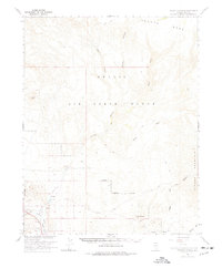
1966 Map of Thirsty Canyon
USGS Topo · Published 1977About this map
Nellis Air Force Range dominates this mid-century topographic study, which was produced in cooperation with the Atomic Energy Commission. The landscape is defined by the sharp transition between the high Pahute Mesa and the drainage systems of Thirsty Canyon and Rocket Wash. Evidence of earlier human activity is preserved in the southwest corner, where an Old Railroad Grade follows the Amargosa River near the Oasis Valley.
Find a feature on this map
32 named features on this map. Tap any name to fly to it.
Don’t see what you’re looking for? This feature index may not catch every label — zoom into the map to look around manually.
Map Details
Editions of this 1966 Thirsty Canyon Map
2 editions found
Other maps of this area

1908 · Kawich
USGS Topo · 1:250,000

1908 · Furnace Creek
USGS Topo · 1:250,000

1910 · Furnace Creek
USGS Topo · 1:250,000

1942 · Tolicha Peak
USGS Topo · 1:125,000

1942 · Wheelbarrow Peak
USGS Topo · 1:125,000

1942 · Skull Mountain
USGS Topo · 1:125,000

1942 · Bullfrog
USGS Topo · 1:125,000

1948 · Death Valley
USGS Topo · 1:250,000

1952 · Topopah Spring
USGS Topo · 1:62,500

1952 · Timber Mountain
USGS Topo · 1:62,500