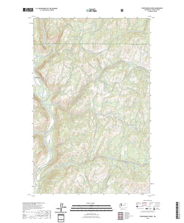
2023 Map of Thirteenmile Creek
USGS Topo · Published 2023About this map
Colville National Forest dominates this mountain landscape, where a series of numbered drainages carve through the high country of Ferry County. The Sanpoil River flows along the western edge, joined by numerous eastward-reaching tributaries including Thirteenmile Creek, Seventeenmile Creek, and Nineteenmile Creek. Near the small settlement of West Fork, the terrain is marked by a network of forest and Bureau of Indian Affairs routes, such as BIA Rd 1050 and BIA Rd 1007.
Find a feature on this map
26 named features on this map. Tap any name to fly to it.
Don’t see what you’re looking for? This feature index may not catch every label — zoom into the map to look around manually.
Map Details
Editions of this 2023 Thirteenmile Creek Map
This is the sole edition of this map. No revisions or reprints were ever made.
Other maps of this area

1904 · Republic
USGS Topo · 1:125,000

1948 · Republic
USGS Topo · 1:62,500

1951 · Wauconda
USGS Topo · 1:62,500

1951 · Republic
USGS Topo · 1:62,500

1953 · Seventeenmile Mtn.
USGS Topo · 1:62,500

1953 · Bald Knob
USGS Topo · 1:62,500

1954 · Okanogan
USGS Topo · 1:250,000

1958 · Okanogan
USGS Topo · 1:250,000

1958 · Aeneas
USGS Topo · 1:62,500

1984 · Republic
USGS Topo · 1:100,000