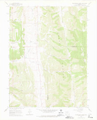
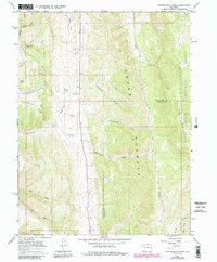
1966 Map of Thirteenmile Creek
USGS Topo · Published 1976About this map
Grand Hogback and White River Mountain dominate the topography of this portion of Northwest Colorado, where the landscape is defined by deep gulches and significant drainage systems. The survey captures the border between Rio Blanco Co and Garfield Co, documenting a region where land use centered on natural resource extraction and ranching. The presence of several Gravel Pits and the extensive Ute Stock Driveway highlights the local economy's reliance on the terrain's physical offerings during the mid-1960s.
Find a feature on this map
26 named features on this map. Tap any name to fly to it.
Don’t see what you’re looking for? This feature index may not catch every label — zoom into the map to look around manually.
Map Details
Editions of this 1966 Thirteenmile Creek Map
5 editions found
Other maps of this area

1906 · Grand Hogback
USGS Topo · 1:125,000

1910 · Grand Hogback
USGS Topo · 1:125,000

1925 · Parachute Creek
USGS Topo · 1:62,500

1927 · Parachute Creek
USGS Topo · 1:62,500

1952 · Rio Blanco
USGS Topo · 1:24,000

1952 · Horse Mountain
USGS Topo · 1:24,000

1952 · No Name Ridge
USGS Topo · 1:24,000

1952 · Segar Mountain
USGS Topo · 1:24,000

1956 · Grand Junction
USGS Topo · 1:250,000

1957 · Leadville
USGS Topo · 1:250,000