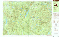
1997 Map of Thirteenth Lake
USGS Topo · Published 1999About this map
The high peaks and water systems of the Adirondack Park define this landscape, where the town of Johnsburg meets the borders of Indian Lake and Wells. Centered on the deep waters of Thirteenth Lake, the terrain rises sharply to the summit of Gore Mountain in the east and Bullhead Mountain to the west. This late-twentieth-century survey documents the region's recreational and industrial heritage, from the developed Ski Trail networks to the hydrological infrastructure of the North Creek Reservoir and the Upper Dam at Botheration Pond. The upper reaches of the Hudson River cut through the northeast corner, punctuated by Mouse Rapids and Perry Ehlers Rapids. Remote landmarks like the Shelter at John Pond and the small settlement of Sodom highlight the sparse human footprint within the rugged mountain passes of Hamilton and Warren counties.
Find a feature on this map
90 named features on this map. Tap any name to fly to it.
Don’t see what you’re looking for? This feature index may not catch every label — zoom into the map to look around manually.
Map Details
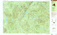
Editions of this 1997 Thirteenth Lake Map
2 editions found
Other maps of this area

1895 · North Creek
USGS Topo · 1:62,500

1897 · North Creek
USGS Topo · 1:62,500

1897 · Schroon Lake
USGS Topo · 1:62,500

1898 · Newcomb
USGS Topo · 1:62,500

1898 · Thirteenth Lake
USGS Topo · 1:62,500

1899 · Indian Lake
USGS Topo · 1:62,500

1901 · Newcomb
USGS Topo · 1:62,500

1902 · Indian Lake
USGS Topo · 1:62,500

1903 · Blue Mountain
USGS Topo · 1:62,500

1950 · Glens Falls
USGS Topo · 1:250,000