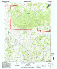
1994 Map of Thirtynine Mile Mountain
USGS Topo · Published 1998About this map
Guffey serves as the primary hub for this high-altitude landscape in southern Park County, situated amidst the complex terrain of the Pike National Forest. The prominent volcanic massif of Thirtynine Mile Mountain dominates the center of the sheet, surrounded by a dense network of watercourses including Currant Creek, Fourmile Creek, and the evocatively named Balm of Gilead Creek. Evidence of resource extraction and infrastructure is visible throughout, marked by scattered Prospects and the linear path of the Homestake Pipeline. This 1994 revision captures a region shaped by ranching and small-scale mining history, where high-country meadows like Chumway Park contrast with the deep drainages of Sheep Gulch and Dicks Creek. The survey provides a clear view of the rural road network and section lines that define property and resource management within the Colorado mountains during the late 20th century.
Find a feature on this map
23 named features on this map. Tap any name to fly to it.
Don’t see what you’re looking for? This feature index may not catch every label — zoom into the map to look around manually.
Map Details
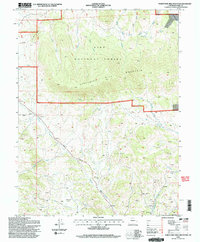
Editions of this 1994 Thirtynine Mile Mountain Map
2 editions found
Other maps of this area

1894 · Pikes Peak
USGS Topo · 1:125,000

1901 · Pikes Peak
USGS Topo · 1:125,000

1942 · Cover Mtn.
USGS Topo · 1:62,500

1948 · Cover Mtn.
USGS Topo · 1:62,500

1954 · Pueblo
USGS Topo · 1:250,000

1956 · Elevenmile Canyon
USGS Topo · 1:24,000

1956 · Guffey NW
USGS Topo · 1:24,000

1956 · Spinney Mountain
USGS Topo · 1:24,000

1957 · Pueblo
USGS Topo · 1:250,000

1958 · Pueblo
USGS Topo · 1:250,000