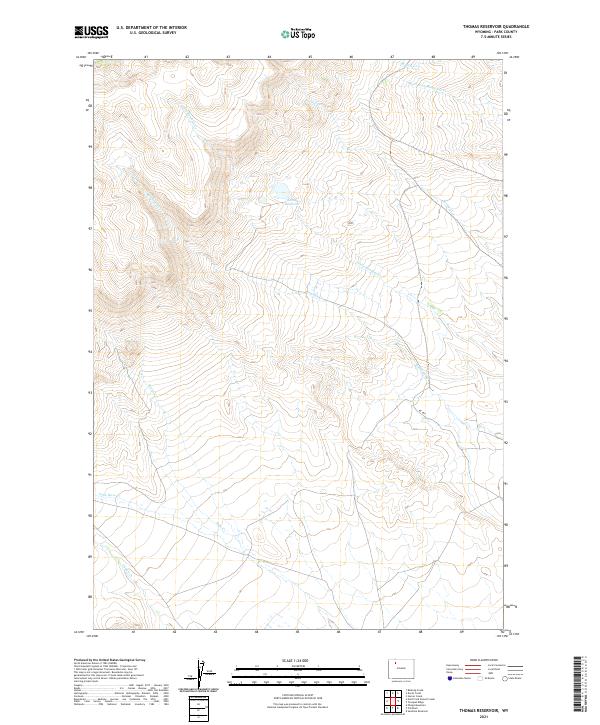
2021 Map of Thomas Reservoir
USGS Topo · Published 2021About this map
Thomas Reservoir sits at the center of this high-elevation landscape in Park County, where the hydrology of the Absaroka Range foothills is intricately mapped. The drainage patterns define the territory, with Little Rawhide Cr and the larger Rawhide Cr carving through the western sections. These seasonal and perennial waterways are critical to the region's ranching history, supporting life in an arid environment.
Find a feature on this map
14 named features on this map. Tap any name to fly to it.
Don’t see what you’re looking for? This feature index may not catch every label — zoom into the map to look around manually.
Map Details
Editions of this 2021 Thomas Reservoir Map
This is the sole edition of this map. No revisions or reprints were ever made.
Other maps of this area

1955 · Cody
USGS Topo · 1:250,000

1957 · Wapiti
USGS Topo · 1:62,500

1957 · Devils Tooth
USGS Topo · 1:62,500

1957 · Irish Rock
USGS Topo · 1:62,500

1957 · Sunshine Reservoir
USGS Topo · 1:62,500

1958 · Cody
USGS Topo · 1:250,000

1962 · Cody
USGS Topo · 1:250,000

1980 · Carter Mountain
USGS Topo · 1:100,000
1987 · Devils Tooth
USGS Topo · 1:24,000
1987 · Pitchfork
USGS Topo · 1:24,000