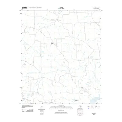
2010 Map of Thomas
USGS Topo · Published 2010About this map
Simpsonville and Thomas anchor the northern landscape of this Upshur County region, where the network of rural routes reflects a deeply established agricultural and residential pattern. The terrain is defined by a dense system of seasonal and permanent waterways, most notably Little Cypress Creek and Prairie Creek, which drain the rolling land toward the south. Small, distinct communities like Soules Chapel and Enon are linked by a grid of farm-to-market roads and secondary routes uniquely named after animals, such as Giraffe Rd and Mule Deer Rd.
Find a feature on this map
64 named features on this map. Tap any name to fly to it.
Don’t see what you’re looking for? This feature index may not catch every label — zoom into the map to look around manually.
Map Details
Editions of this 2010 Thomas Map
This is the sole edition of this map. No revisions or reprints were ever made.
Other maps of this area

1956 · Tyler
USGS Topo · 1:250,000

1960 · Shady Grove
USGS Topo · 1:24,000

1960 · Pritchett
USGS Topo · 1:24,000

1960 · Bettie
USGS Topo · 1:24,000

1960 · Gilmer
USGS Topo · 1:24,000

1960 · Thomas
USGS Topo · 1:24,000

1960 · Newsome
USGS Topo · 1:24,000

1960 · Leesburg
USGS Topo · 1:24,000

1960 · Rhonesboro
USGS Topo · 1:24,000

1960 · Pittsburg
USGS Topo · 1:24,000