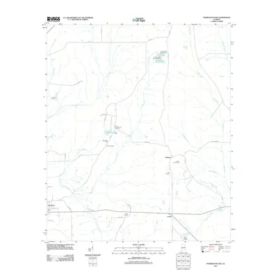
2011 Map of Thomaston East
USGS Topo · Published 2011About this map
Thomaston sits at the western edge of this Marengo County landscape, which transitions from the small town center into a network of managed water and rural homesteads. The topography is defined by the meandering Chickasaw Bogue and numerous smaller drainages like Turkeypen Creek and Poplar Creek. A significant amount of local history is preserved through the naming of small burial grounds and water control features. Family names and local legacy are evident in landmarks such as Stallworths Shadow Lake and Stallworths Dam, as well as the Jericho Cemetery and Glovers Cemetery that dot the countryside. Near the settlement of McKinley, several cemeteries including Bethel Hill Cemetery and Zion Cemetery highlight the area’s long-standing residential patterns. In the north, Prairie Lake Number One and Prairie Lake Number Two represent modern agricultural or recreational water management within the Alabama Black Belt.
Find a feature on this map
52 named features on this map. Tap any name to fly to it.
Don’t see what you’re looking for? This feature index may not catch every label — zoom into the map to look around manually.
Map Details
Editions of this 2011 Thomaston East Map
This is the sole edition of this map. No revisions or reprints were ever made.
Other maps of this area

1953 · Montgomery
USGS Topo · 1:250,000

1956 · Montgomery
USGS Topo · 1:250,000

1957 · Montgomery
USGS Topo · 1:250,000

1968 · Thomaston East
USGS Topo · 1:24,000

1968 · Uniontown West
USGS Topo · 1:24,000

1968 · Uniontown East
USGS Topo · 1:24,000

1968 · Thomaston West
USGS Topo · 1:24,000

1968 · Gallion
USGS Topo · 1:24,000

1968 · Central Mills
USGS Topo · 1:24,000

1974 · Catherine
USGS Topo · 1:24,000