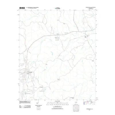
2011 Map of Thomasville
USGS Topo · Published 2011About this map
Thomasville serves as the primary hub for this portion of Clarke County, situated at the confluence of several regional transit routes. The landscape transitions from the urbanized streets of the town center to a series of rural communities and crossroads, including Atkeison, Finley Crossing, and Sunny South. The distribution of family and community burial grounds, such as Airmount Cemetery and Finley Crossing Cemetery, indicates long-standing local lineage and settlement patterns. To the south, water management and recreation are evident through features like Lake Crow, the Homer A Crow Dam, and the Thomasville Sewer Lagoon Dam. Significant natural drainages such as Beaver Creek and Bassett Creek carve through the terrain, which is also home to the distinctive Double Natural Bridges near the southern boundary. This survey documents the intersection of modern municipal infrastructure with historical Alabama rural life.
Find a feature on this map
62 named features on this map. Tap any name to fly to it.
Don’t see what you’re looking for? This feature index may not catch every label — zoom into the map to look around manually.
Map Details
Editions of this 2011 Thomasville Map
This is the sole edition of this map. No revisions or reprints were ever made.
Other maps of this area

1953 · Montgomery
USGS Topo · 1:250,000

1953 · Andalusia
USGS Topo · 1:250,000

1956 · Montgomery
USGS Topo · 1:250,000

1957 · Montgomery
USGS Topo · 1:250,000

1957 · Andalusia
USGS Topo · 1:250,000

1973 · Fulton East
USGS Topo · 1:24,000

1973 · Pine Hill
USGS Topo · 1:24,000

1973 · Thomasville
USGS Topo · 1:24,000

1973 · Lower Peach Tree
USGS Topo · 1:24,000

1978 · Surginer
USGS Topo · 1:24,000