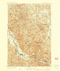
1937 Map of Thompson Falls
USGS Topo · Published 1937About this map
Thompson Falls serves as the primary hub on this mid-1930s survey, situated along the Clark Fork where the Northern Pacific railroad and the State Highway follow the river's winding path through the valley. The landscape is defined by the high peaks of the Cabinet National Forest and Kootenai National Forest, showing a rugged network of forest service lookouts and isolated water bodies like Stony Lake and Mammot Lakes.
Find a feature on this map
76 named features on this map. Tap any name to fly to it.
Don’t see what you’re looking for? This feature index may not catch every label — zoom into the map to look around manually.
Map Details
Editions of this 1937 Thompson Falls Map
2 editions found

Other maps of this area

1914 · Avery
USGS Topo · 1:125,000

1917 · Avery
USGS Topo · 1:125,000

1918 · St Regis
USGS Topo · 1:125,000

1919 · St. Regis
USGS Topo · 1:125,000

1920 · Libby
USGS Topo · 1:125,000

1920 · Jennings
USGS Topo · 1:125,000

1930 · Libby
USGS Topo · 1:125,000

1932 · Libby
USGS Topo · 1:125,000

1932 · Trout Creek
USGS Topo · 1:125,000

1935 · Thompson Lakes
USGS Topo · 1:96,000