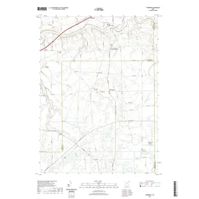
2019 Map of Thompson
USGS Topo · Published 2019About this map
The Grand River carves a deep valley through the northern portion of this landscape, creating the dramatic relief of Madison Palisades and the surrounding wooded bluffs. This 2019 survey captures the rural character of Geauga and Lake counties, where small settlements like Thompson and South Madison are anchored by long-standing local landmarks. A notable density of private aviation and recreational sites is scattered throughout, including Sky Haven Airport, Pheasant Run Airport, and the specialized Thompson Drag Raceway Airport.
Find a feature on this map
90 named features on this map. Tap any name to fly to it.
Don’t see what you’re looking for? This feature index may not catch every label — zoom into the map to look around manually.
Map Details
Editions of this 2019 Thompson Map
This is the sole edition of this map. No revisions or reprints were ever made.
Other maps of this area

1904 · Chardon
USGS Topo · 1:62,500

1905 · Ashtabula
USGS Topo · 1:62,500

1905 · Perry
USGS Topo · 1:62,500

1905 · Jefferson
USGS Topo · 1:62,500

1906 · Chardon
USGS Topo · 1:62,500

1907 · Jefferson
USGS Topo · 1:62,500

1950 · Cleveland
USGS Topo · 1:250,000

1953 · Chardon
USGS Topo · 1:24,000

1956 · Cleveland
USGS Topo · 1:250,000
1959 · East Claridon
USGS Topo · 1:24,000