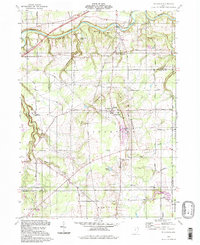
1994 Map of Thompson
USGS Topo · Published 1997About this map
The Ledges and Under Ledges define the dramatic topography of this section of the Connecticut Western Reserve, where the high ground of Thompson drops away toward the State Scenic Grand River valley. The map reveals a landscape shaped by glacial activity and drainage patterns, specifically around the deeply recessed Hell Hole and the headwaters of Phelps Creek. Local life centers on the village of Thompson, featuring Ledgemont High Sch, Maple Grove Cem, and Thompson Ledge Township Park. Aviation landmarks such as Heitz Airfield and an Airway Beacon suggest the area's role in regional navigation. The surrounding countryside is dotted with rural institutions like St Patricks Ch and Grace Ch, alongside sand and gravel operations that point to the local geological resources being utilized at the end of the twentieth century.
Find a feature on this map
52 named features on this map. Tap any name to fly to it.
Don’t see what you’re looking for? This feature index may not catch every label — zoom into the map to look around manually.
Map Details
Editions of this 1994 Thompson Map
This is the sole edition of this map. No revisions or reprints were ever made.
Other maps of this area

1904 · Chardon
USGS Topo · 1:62,500

1905 · Ashtabula
USGS Topo · 1:62,500

1905 · Perry
USGS Topo · 1:62,500

1905 · Jefferson
USGS Topo · 1:62,500

1906 · Chardon
USGS Topo · 1:62,500

1907 · Jefferson
USGS Topo · 1:62,500

1950 · Cleveland
USGS Topo · 1:250,000

1953 · Chardon
USGS Topo · 1:24,000

1956 · Cleveland
USGS Topo · 1:250,000
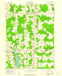
1959 · East Claridon
USGS Topo · 1:24,000