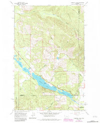
1966 Map of Thompson Lakes
USGS Topo · Published 1984About this map
The Thompson Lakes chain dominates this terrain within the Kootenai National Forest, where the waters of Upper Lake, Middle Lake, and Lower Lake create a distinct hydrological corridor. This 1966 survey, later revised to reflect the landscape of the early 1980s, highlights the recreational and natural resource character of the region. The map documents the presence of Logan Park Campground and several designated picnic areas along the lake margins, while the surrounding uplands like Meadow Ridge and Bowers Peak are accessible via routes such as the Barnum Trail. Localized industry is noted through scattered Gravel Pits near the shorelines. This sheet captures a critical intersection of three counties, marking the boundary where Lincoln, Flathead, and Sanders meet, and traces the flow of the Thompson River as it exits the lower lake.
Find a feature on this map
29 named features on this map. Tap any name to fly to it.
Don’t see what you’re looking for? This feature index may not catch every label — zoom into the map to look around manually.
Map Details
Editions of this 1966 Thompson Lakes Map
2 editions found
Other maps of this area

1920 · Jennings
USGS Topo · 1:125,000

1935 · Thompson Lakes
USGS Topo · 1:96,000

1937 · Thompson Falls
USGS Topo · 1:125,000

1942 · Thompson Lakes
USGS Topo · 1:125,000

1956 · Wallace
USGS Topo · 1:250,000

1957 · Kalispell
USGS Topo · 1:250,000

1960 · Kalispell
USGS Topo · 1:250,000

1960 · Wallace
USGS Topo · 1:250,000

1961 · Kalispell
USGS Topo · 1:250,000

1964 · Meadow Peak
USGS Topo · 1:24,000