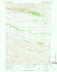
1965 Map of Thompson Reservoirs
USGS Topo · Published 1968About this map
Wind River Indian Reservation Boundary lines bisect this mid-1960s landscape, marking a transition between the elevated relief of Padlock Rim and the hydrologic networks below. The map documents a rugged drainage system where Owl Creek and Pumpkin Draw navigate toward the east, supported by early water management features like Thompson Reservoir No 1 and its counterpart, Thompson Reservoir No 2.
Find a feature on this map
22 named features on this map. Tap any name to fly to it.
Don’t see what you’re looking for? This feature index may not catch every label — zoom into the map to look around manually.
Map Details
Editions of this 1965 Thompson Reservoirs Map
This is the sole edition of this map. No revisions or reprints were ever made.
Other maps of this area

1913 · Grass Creek Basin
USGS Topo · 1:62,500

1914 · Blue Mesa
USGS Topo · 1:62,500

1915 · Grass Creek Basin
USGS Topo · 1:62,500

1916 · Blue Mesa
USGS Topo · 1:62,500

1952 · Kates Basin
USGS Topo · 1:24,000

1955 · Thermopolis
USGS Topo · 1:250,000

1958 · Thermopolis
USGS Topo · 1:250,000

1962 · Thermopolis
USGS Topo · 1:250,000

1965 · Arapahoe Ranch
USGS Topo · 1:24,000
1965 · Potato Butte
USGS Topo · 1:24,000