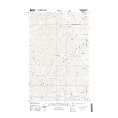
2014 Map of Thompson Ridge
USGS Topo · Published 2014About this map
The Okanogan National Forest covers this landscape, centered on the high divide of Thompson Ridge. This 2014 survey documents the complex drainage systems of the Cascade foothills, where the Twisp River cuts through the southern reaches and Wolf Cr flows through the north. The protected Wolf Creek Research Natural Area occupies the northeastern slopes of Virginian Ridge, preserving a specific ecological niche within the forest.
Find a feature on this map
39 named features on this map. Tap any name to fly to it.
Don’t see what you’re looking for? This feature index may not catch every label — zoom into the map to look around manually.
Map Details
Editions of this 2014 Thompson Ridge Map
This is the sole edition of this map. No revisions or reprints were ever made.
Other maps of this area
1899 · Methow
USGS Topo · 1:125,000
1901 · Methow
USGS Topo · 1:125,000

1955 · Concrete
USGS Topo · 1:250,000

1958 · Concrete
USGS Topo · 1:250,000

1962 · Concrete
USGS Topo · 1:250,000
1962 · Mazama
USGS Topo · 1:62,500
1963 · Doe Mountain
USGS Topo · 1:62,500
1969 · Midnight Mtn.
USGS Topo · 1:24,000
1969 · Thompson Ridge
USGS Topo · 1:24,000
1969 · Buttermilk Butte
USGS Topo · 1:62,500