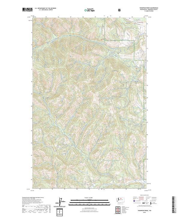
2023 Map of Thompson Ridge
USGS Topo · Published 2023About this map
Okanogan National Forest dominates this landscape, where the high terrain of Thompson Ridge separates several significant drainage systems. In the northwest, the Lake Chelan-Sawtooth Wilderness protects the headwaters of the North Fork Wolf Creek. The map reveals a network of recreational and access routes, including the Wolf Creek Trl and the Methow Community Trl, which follow the valley floors. Several residential or forest service roads like Wolf Song Rd and Sirinok Ln appear in the northeastern corner near the Wolf Creek corridor. The geography is defined by numerous named tributaries such as Little Bridge Creek, Sheep Creek, and Deer Creek, illustrating a complex watershed that eventually feeds into the Twisp River at the southern boundary.
Find a feature on this map
46 named features on this map. Tap any name to fly to it.
Don’t see what you’re looking for? This feature index may not catch every label — zoom into the map to look around manually.
Map Details
Editions of this 2023 Thompson Ridge Map
This is the sole edition of this map. No revisions or reprints were ever made.
Other maps of this area

1899 · Methow
USGS Topo · 1:125,000

1901 · Methow
USGS Topo · 1:125,000

1955 · Concrete
USGS Topo · 1:250,000

1958 · Concrete
USGS Topo · 1:250,000

1962 · Concrete
USGS Topo · 1:250,000

1962 · Mazama
USGS Topo · 1:62,500

1963 · Doe Mountain
USGS Topo · 1:62,500
1969 · Midnight Mtn.
USGS Topo · 1:24,000
1969 · Thompson Ridge
USGS Topo · 1:24,000
1969 · Buttermilk Butte
USGS Topo · 1:62,500