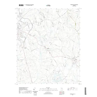
2020 Map of Thomson East
USGS Topo · Published 2020About this map
The McDuffie County Courthouse marks the western edge of this survey, which details the transition from the city of Thomson into the smaller communities of Boneville and Dearing. The landscape is defined by an intricate network of waterways, including the winding Sweetwater Cr and several namesake ponds like Boatwright Pond and Boneville Pond. A concentration of family-named cemeteries such as Watson Family Cem, Ivory Family Cem, and Paul Cem provides significant data for genealogists tracing the rural heritage of eastern Georgia. In the southeastern portion of the quadrangle, a unique series of numbered water bodies—Dearing Number 10 Lake, Dearing Number 11 Lake, and Dearing Number 13 Lake—suggests a history of managed water resources or agricultural development between Headstall Cr and the McDuffie and Columbia county line.
Find a feature on this map
165 named features on this map. Tap any name to fly to it.
Don’t see what you’re looking for? This feature index may not catch every label — zoom into the map to look around manually.
Map Details
Editions of this 2020 Thomson East Map
This is the sole edition of this map. No revisions or reprints were ever made.
Other maps of this area

1892 · Mc Cormick
USGS Topo · 1:125,000

1906 · Crawfordville
USGS Topo · 1:125,000

1912 · Mc Cormick
USGS Topo · 1:125,000

1921 · Appling
USGS Topo · 1:62,500

1922 · Harlem
USGS Topo · 1:62,500

1943 · Appling
USGS Topo · 1:62,500

1948 · Harlem
USGS Topo · 1:62,500

1948 · Harlem
USGS Topo · 1:24,000

1948 · Thomson East
USGS Topo · 1:24,000

1950 · Dearing
USGS Topo · 1:24,000