
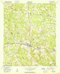
1948 Map of Thomson East
USGS Topo · Published 1981About this map
The Georgia RR cuts a path through this landscape, connecting the growing settlements of Thomson, Boneville, and Dearing during the mid-20th century. This area on the Columbia McDuffie Co line is defined by a dense network of family-named landmarks and rural community centers. Genealogists will find significant value in the detailed plotting of the Watson Family Cemetery, Ivory Family Cemetery, and Paul Cemetery.
Find a feature on this map
46 named features on this map. Tap any name to fly to it.
Don’t see what you’re looking for? This feature index may not catch every label — zoom into the map to look around manually.
Map Details
Editions of this 1948 Thomson East Map
This is the sole edition of this map. No revisions or reprints were ever made.
Other maps of this area

1892 · Mc Cormick
USGS Topo · 1:125,000

1906 · Crawfordville
USGS Topo · 1:125,000

1912 · Mc Cormick
USGS Topo · 1:125,000

1921 · Appling
USGS Topo · 1:62,500

1922 · Harlem
USGS Topo · 1:62,500

1943 · Appling
USGS Topo · 1:62,500

1948 · Harlem
USGS Topo · 1:62,500

1948 · Harlem
USGS Topo · 1:24,000

1950 · Dearing
USGS Topo · 1:24,000
1950 · Harlem
USGS Topo · 1:24,000