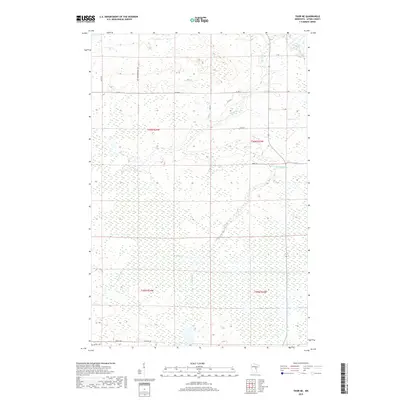
2019 Map of Thor NE
USGS Topo · Published 2019About this map
Rice River meanders through this portion of Aitkin County, defining a landscape dominated by complex hydrology and wetland systems. This 2019 survey captures the modern road network that provides access to the region's interior, including Co Hwy 4 and local routes like Lee Township Road 122. The naming of local ways such as Jewett Rd and That Dam Rd often points to family lineage or historical water management structures in the area. Smaller waterways like Section Five Cr, Beckman Cr, and Dam Brook drain the surrounding terrain, which is carefully gridded by the Public Land Survey System, as evidenced by the township and range boundaries of t46n r24w and its neighbors. The interplay between these narrow streams and the rural road system illustrates the persistent remote character of this Minnesota landscape.
Find a feature on this map
20 named features on this map. Tap any name to fly to it.
Don’t see what you’re looking for? This feature index may not catch every label — zoom into the map to look around manually.
Map Details
Editions of this 2019 Thor NE Map
This is the sole edition of this map. No revisions or reprints were ever made.
Other maps of this area

1953 · Duluth
USGS Topo · 1:250,000

1958 · Duluth
USGS Topo · 1:250,000

1969 · Solana
USGS Topo · 1:24,000

1969 · Thor NE
USGS Topo · 1:24,000

1969 · Thor SE
USGS Topo · 1:24,000

1969 · Thor SW
USGS Topo · 1:24,000

1969 · Thor
USGS Topo · 1:24,000

1969 · Split Rock Lake
USGS Topo · 1:24,000

1969 · Lawler
USGS Topo · 1:24,000

1970 · Kimberly
USGS Topo · 1:24,000