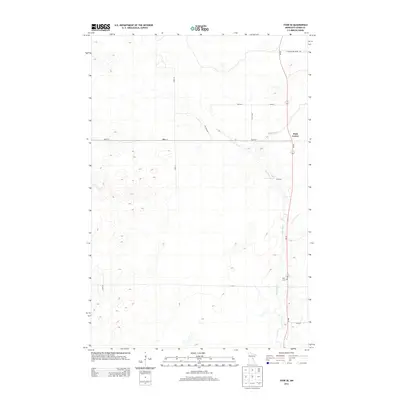
2013 Map of Thor SE
USGS Topo · Published 2013About this map
The Snake River winds south through this portion of Aitkin County, dictating the local road patterns and land use in this part of Minnesota. The settlement at Dads Corner sits at the intersection of MN-65 and 220th St, serving as a central point for the surrounding rural area. Genealogists may find interest in the Pliny Cem, located further south along the highway near the river banks. The map depicts a grid of local access roads and trails, such as the E White Pine Truck Trl and The Back Rd, which cut through the low-lying terrain. The landscape is characterized by numerous small depressions and drainage patterns that feed into the river system, reflecting the hydrologic nature of the region near Roth Rd.
Find a feature on this map
14 named features on this map. Tap any name to fly to it.
Don’t see what you’re looking for? This feature index may not catch every label — zoom into the map to look around manually.
Map Details
Editions of this 2013 Thor SE Map
This is the sole edition of this map. No revisions or reprints were ever made.
Other maps of this area

1953 · Duluth
USGS Topo · 1:250,000

1958 · Duluth
USGS Topo · 1:250,000

1968 · Kroschel NW
USGS Topo · 1:24,000

1968 · Isle
USGS Topo · 1:24,000

1968 · Mc Grath
USGS Topo · 1:24,000

1969 · Solana
USGS Topo · 1:24,000

1969 · Thor NE
USGS Topo · 1:24,000

1969 · Thor SE
USGS Topo · 1:24,000

1969 · Thor SW
USGS Topo · 1:24,000

1969 · Thor
USGS Topo · 1:24,000