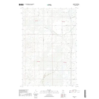
2019 Map of Thor SE
USGS Topo · Published 2019About this map
The Snake River meanders through the eastern portion of this Aitkin County landscape, defining the character of the terrain as it flows past the Pliny Cem. This 2019 survey captures a quiet, rural stretch of Minnesota where the drainage patterns of the river dominate the low-lying geography. The road network reflects a remote residential and agricultural layout, featuring evocative names such as The Back Rd, Lonesome Trail Rd, and Fur Buyer Rd. This specific area, encompassing the intersection of multiple township and range boundaries including t45n r24w and t45n r23w, is marked by extensive wetlands and isolated woodlots typical of the region's interior drainage basins. Major local thoroughfares like Co Hwy 2 and Co Hwy 26 provide the primary east-west access through this sparsely populated northern terrain.
Find a feature on this map
23 named features on this map. Tap any name to fly to it.
Don’t see what you’re looking for? This feature index may not catch every label — zoom into the map to look around manually.
Map Details
Editions of this 2019 Thor SE Map
This is the sole edition of this map. No revisions or reprints were ever made.
Other maps of this area

1953 · Duluth
USGS Topo · 1:250,000

1958 · Duluth
USGS Topo · 1:250,000

1968 · Kroschel NW
USGS Topo · 1:24,000

1968 · Isle
USGS Topo · 1:24,000

1968 · Mc Grath
USGS Topo · 1:24,000

1969 · Solana
USGS Topo · 1:24,000

1969 · Thor NE
USGS Topo · 1:24,000

1969 · Thor SE
USGS Topo · 1:24,000

1969 · Thor SW
USGS Topo · 1:24,000

1969 · Thor
USGS Topo · 1:24,000