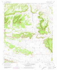
1963 Map of Thoreau NE
USGS Topo · Published 1981About this map
Atchison Topeka and Santa Fe railroad tracks cut across the southern edge of this high-desert landscape, following the lower terrain through a series of significant drainage basins. The map captures the area as it was surveyed in the late 1950s and updated into the early 1980s, revealing a landscape defined by sharp mesas and deep draws. Local activity is concentrated near the rail line and along Casamero Draw and Mitchell Draw, where the Andrews Ranch and several Mines suggest a history of livestock ranching and resource extraction. The northeast portion of the quadrangle is dominated by the steep walls of Rincon Canyon, illustrating the transition from flat valley floors to the elevated plateau country of northwestern New Mexico.
Find a feature on this map
6 named features on this map. Tap any name to fly to it.
Don’t see what you’re looking for? This feature index may not catch every label — zoom into the map to look around manually.
Map Details
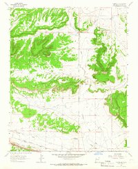
Editions of this 1963 Thoreau NE Map
2 editions found
Other maps of this area

1883 · Mt. Taylor
USGS Topo · 1:250,000

1886 · Wingate
USGS Topo · 1:250,000

1886 · Mt. Taylor
USGS Topo · 1:250,000

1892 · Wingate
USGS Topo · 1:250,000

1892 · Mt. Taylor
USGS Topo · 1:250,000

1899 · Mt. Taylor
USGS Topo · 1:250,000

1954 · Gallup
USGS Topo · 1:250,000

1957 · Bluewater
USGS Topo · 1:24,000

1957 · Goat Mountain
USGS Topo · 1:24,000

1958 · Gallup
USGS Topo · 1:250,000