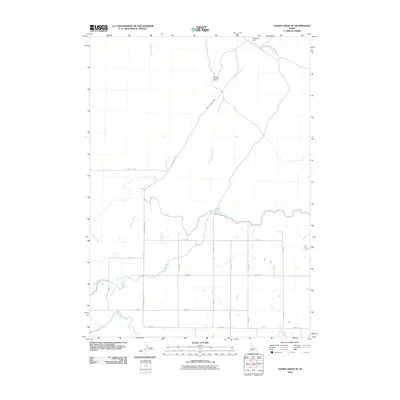
2010 Map of Thorn Creek SE
USGS Topo · Published 2010About this map
Patterson Dam controls the northern water flow in this region of Gooding County, Idaho, where a complex irrigation network supports the local agricultural landscape. The map details the sophisticated water management systems that define this area, including the Milner Gooding Canal and the North Gooding Main Canal which traverse the southern portion of the sheet. These man-made channels intersect natural drainage patterns formed by Thorn Creek and Preacher Creek, illustrating the intersection of natural hydrology and engineering.
Find a feature on this map
25 named features on this map. Tap any name to fly to it.
Don’t see what you’re looking for? This feature index may not catch every label — zoom into the map to look around manually.
Map Details
Editions of this 2010 Thorn Creek SE Map
This is the sole edition of this map. No revisions or reprints were ever made.
Other maps of this area

1955 · Twin Falls
USGS Topo · 1:250,000

1955 · Hailey
USGS Topo · 1:250,000

1957 · Thorn Creek SE
USGS Topo · 1:24,000

1957 · Thorn Creek SW
USGS Topo · 1:24,000

1957 · Thorn Creek
USGS Topo · 1:62,500

1958 · Twin Falls
USGS Topo · 1:250,000

1959 · Hailey
USGS Topo · 1:250,000

1962 · Hailey
USGS Topo · 1:250,000

1971 · Tunupa
USGS Topo · 1:24,000
1971 · Gooding
USGS Topo · 1:24,000