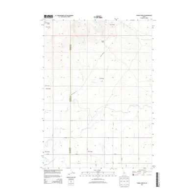
2013 Map of Thorn Creek SE
USGS Topo · Published 2013About this map
The Milner Gooding Canal cuts across this high-desert landscape in southern Idaho, illustrating the critical irrigation infrastructure required to support agriculture along the border of Gooding Co and Lincoln Co. In this region north of the Big Wood River, the map shows a transition from the natural drainage of Rattlesnake Canyon and Timber Gulch to a controlled water system. Man-made features like the North Gooding Main Canal, Robertson Ditch, and Seven Hundred Reservoir define the modern utility of the land, while seasonal waterways such as Preacher Cr, Portuguese Cr, and Thorn Cr flow southward through the sagebrush-covered plains. This survey documents the intersection of rural Idaho ranching territory and the extensive hydraulic engineering that transformed the Snake River Plain.
Find a feature on this map
15 named features on this map. Tap any name to fly to it.
Don’t see what you’re looking for? This feature index may not catch every label — zoom into the map to look around manually.
Map Details
Editions of this 2013 Thorn Creek SE Map
This is the sole edition of this map. No revisions or reprints were ever made.
Other maps of this area

1955 · Twin Falls
USGS Topo · 1:250,000

1955 · Hailey
USGS Topo · 1:250,000

1957 · Thorn Creek SE
USGS Topo · 1:24,000

1957 · Thorn Creek SW
USGS Topo · 1:24,000

1957 · Thorn Creek
USGS Topo · 1:62,500

1958 · Twin Falls
USGS Topo · 1:250,000

1959 · Hailey
USGS Topo · 1:250,000

1962 · Hailey
USGS Topo · 1:250,000

1971 · Tunupa
USGS Topo · 1:24,000
1971 · Gooding
USGS Topo · 1:24,000