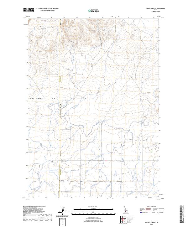
2024 Map of Thorn Creek SE
USGS Topo · Published 2024About this map
Mount Bennett Hills define the northern horizon of this landscape, where the high desert terrain transitions into a highly engineered agricultural corridor. The southern portion of the map reveals the complex irrigation infrastructure essential to this region, centered around the Milner Gooding Canal and the High Line Canal. These primary arteries feed a dense network of smaller channels, including Lateral 916, Lateral 900, and Lateral 700, which transform the arid plains into productive farmland. The Big Wood River cuts through the southwestern corner, joined by the Robertson Ditch, illustrating the historical reliance on local water rights for settlement. A grid of section roads like Preacher Creek Rd and W Co Line Rd provides access to these isolated rural tracts, while natural drainages such as Timber Gulch and Portuguese Creek trace the original contours of the land before the arrival of modern water management.
Find a feature on this map
50 named features on this map. Tap any name to fly to it.
Don’t see what you’re looking for? This feature index may not catch every label — zoom into the map to look around manually.
Map Details
Editions of this 2024 Thorn Creek SE Map
This is the sole edition of this map. No revisions or reprints were ever made.
Other maps of this area

1955 · Twin Falls
USGS Topo · 1:250,000

1955 · Hailey
USGS Topo · 1:250,000

1957 · Thorn Creek SE
USGS Topo · 1:24,000

1957 · Thorn Creek SW
USGS Topo · 1:24,000

1957 · Thorn Creek
USGS Topo · 1:62,500

1958 · Twin Falls
USGS Topo · 1:250,000

1959 · Hailey
USGS Topo · 1:250,000

1962 · Hailey
USGS Topo · 1:250,000

1971 · Tunupa
USGS Topo · 1:24,000
1971 · Gooding
USGS Topo · 1:24,000