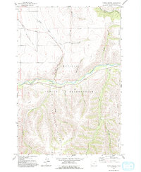
1964 Map of Thorn Hollow
USGS Topo · Published 1993About this map
The Umatilla Indian Reservation dominates this mid-century landscape in Umatilla County, centered on the Umatilla River as it winds through deep canyons. The small settlement of Thorn Hollow sits along the river banks, serving as a focal point for the surrounding high-plateau terrain. Movement through this complex topography is defined by established routes like the Stage Road and significant landforms such as Telephone Ridge and Buckaroo Ridge.
Find a feature on this map
24 named features on this map. Tap any name to fly to it.
Don’t see what you’re looking for? This feature index may not catch every label — zoom into the map to look around manually.
Map Details
Editions of this 1964 Thorn Hollow Map
2 editions found
Other maps of this area

1935 · Pendleton
USGS Topo · 1:125,000

1953 · Pendleton
USGS Topo · 1:250,000

1956 · Pendleton
USGS Topo · 1:250,000

1964 · Thorn Hollow
USGS Topo · 1:24,000

1964 · Athena
USGS Topo · 1:24,000

1964 · Weston Mountain
USGS Topo · 1:24,000

1964 · Duncan
USGS Topo · 1:24,000

1964 · Gibbon
USGS Topo · 1:24,000

1964 · Meacham
USGS Topo · 1:24,000

1966 · Cabbage Hill
USGS Topo · 1:24,000