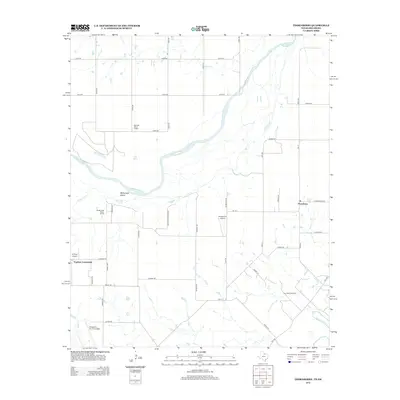
2012 Map of Thornberry
USGS Topo · Published 2012About this map
The Red River defines the border between Texas and Oklahoma in this 2012 survey, winding past McFarland Island and several water supply stations. On the Texas side, the landscape is defined by the energy and aviation sectors, with the Thornberry Oil Field situated in the southeast and the northern edges of Sheppard Air Force Base visible along the southern boundary. Small-scale aviation is well-represented by facilities like Klinkerman Airport and 4-Shipp Airport, reflecting the region's spread-out settlement pattern.
Find a feature on this map
53 named features on this map. Tap any name to fly to it.
Don’t see what you’re looking for? This feature index may not catch every label — zoom into the map to look around manually.
Map Details
Editions of this 2012 Thornberry Map
This is the sole edition of this map. No revisions or reprints were ever made.
Other maps of this area

1915 · Burkburnett
USGS Topo · 1:24,000

1918 · Buckburnett
USGS Topo · 1:31,680

1954 · Wichita Falls
USGS Topo · 1:250,000

1955 · Lawton
USGS Topo · 1:250,000

1957 · Wichita Falls West
USGS Topo · 1:24,000

1957 · Burkburnett
USGS Topo · 1:62,500

1957 · Randlett
USGS Topo · 1:62,500

1957 · Wichita Falls East
USGS Topo · 1:62,500

1957 · Wichita Falls East
USGS Topo · 1:24,000

1957 · Wichita Falls West
USGS Topo · 1:62,500