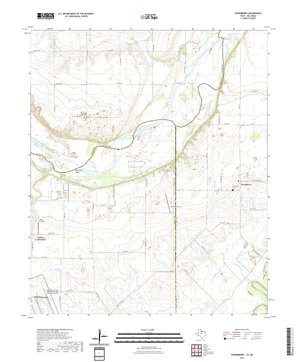
2022 Map of Thornberry
USGS Topo · Published 2022About this map
The Red River defines the border between Texas and Oklahoma in this region northeast of Wichita Falls. The landscape is marked by the shifting channels and bars of the river, including McFarland Island and water sources like Lilly Spring and McFarland Spring. Settlement is concentrated in the small communities of Thornberry and the Cashion Community, while the south-central portion of the map is dominated by the confluence where the Wichita River joins the larger Red River system. Aviation is prominent in the local geography, with Klinkerman Airport and Dave Eby Field situated among the various farm-to-market roads. For genealogists, the Thornberry Cem provides a specific point of interest for tracing early residents of Clay and Wichita counties.
Find a feature on this map
59 named features on this map. Tap any name to fly to it.
Don’t see what you’re looking for? This feature index may not catch every label — zoom into the map to look around manually.
Map Details
Editions of this 2022 Thornberry Map
This is the sole edition of this map. No revisions or reprints were ever made.
Other maps of this area

1915 · Burkburnett
USGS Topo · 1:24,000

1918 · Buckburnett
USGS Topo · 1:31,680

1954 · Wichita Falls
USGS Topo · 1:250,000

1955 · Lawton
USGS Topo · 1:250,000

1957 · Wichita Falls West
USGS Topo · 1:24,000

1957 · Burkburnett
USGS Topo · 1:62,500

1957 · Randlett
USGS Topo · 1:62,500

1957 · Wichita Falls East
USGS Topo · 1:62,500

1957 · Wichita Falls East
USGS Topo · 1:24,000

1957 · Wichita Falls West
USGS Topo · 1:62,500