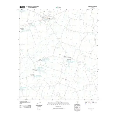
2010 Map of Thorndale
USGS Topo · Published 2010About this map
The town of Thorndale serves as the focal point of this Central Texas landscape, situated near the headwaters of several drainages. The surrounding countryside is defined by an extensive water management system, illustrated by numerous reservoirs and dams such as Soil Conservation Service Site 20 Reservoir and City Lake Number 1. This network of small basins supports the agricultural character of the region between Brushy Creek and Salty Creek. Genealogists will find this map particularly useful for its density of burial sites, including family and community-named landmarks like Connell Cemetery, Thomson Chapel Cemetery, and the Pleasant Retreat Cemetery. Further south, the rural settlements of Conoley and Salty anchor a web of county roads that navigate the subtle rises between Holynok Creek and Little Sandy Creek.
Find a feature on this map
61 named features on this map. Tap any name to fly to it.
Don’t see what you’re looking for? This feature index may not catch every label — zoom into the map to look around manually.
Map Details
Editions of this 2010 Thorndale Map
This is the sole edition of this map. No revisions or reprints were ever made.
Other maps of this area

1885 · Taylor
USGS Topo · 1:125,000

1885 · Bastrop
USGS Topo · 1:125,000

1887 · Taylor
USGS Topo · 1:125,000

1893 · Bastrop
USGS Topo · 1:125,000

1894 · Taylor
USGS Topo · 1:125,000

1904 · Bastrop
USGS Topo · 1:125,000

1948 · Elgin
USGS Topo · 1:62,500

1948 · Lexington
USGS Topo · 1:62,500

1950 · Lexington
USGS Topo · 1:62,500

1950 · Elgin
USGS Topo · 1:62,500