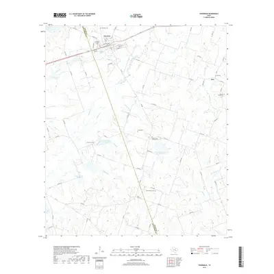
2019 Map of Thorndale
USGS Topo · Published 2019About this map
Thorndale sits at the intersection of modern transport and deep-rooted community history along the Williamson Co and Milam Co line. This survey shows the town's concentration of local landmarks, including the Saint Paul Lutheran Cem and Thorndale Cem, which serve as vital touchstones for genealogical research in the area. The landscape is defined by the branching tributaries of Salty Cr, Brushy Cr, and Sandy Cr, which meander through a countryside marked by numerous small cemeteries such as Salty Cem, Thomson Chapel Cem, and Connell Cem. This distribution of rural burial grounds indicates a long history of family homesteads and small church communities like the one at Salty. Further south, the map details water management features such as the Soil Conservation Service Site 24 Reservoir and City Lake Number One, illustrating the ongoing relationship between the agricultural landscape and regional water resources.
Find a feature on this map
68 named features on this map. Tap any name to fly to it.
Don’t see what you’re looking for? This feature index may not catch every label — zoom into the map to look around manually.
Map Details
Editions of this 2019 Thorndale Map
This is the sole edition of this map. No revisions or reprints were ever made.
Other maps of this area

1885 · Taylor
USGS Topo · 1:125,000

1885 · Bastrop
USGS Topo · 1:125,000

1887 · Taylor
USGS Topo · 1:125,000

1893 · Bastrop
USGS Topo · 1:125,000

1894 · Taylor
USGS Topo · 1:125,000

1904 · Bastrop
USGS Topo · 1:125,000

1948 · Elgin
USGS Topo · 1:62,500

1948 · Lexington
USGS Topo · 1:62,500

1950 · Lexington
USGS Topo · 1:62,500

1950 · Elgin
USGS Topo · 1:62,500