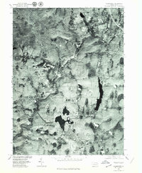
1976 Map of Thornhurst
USGS Topo · Published 1979About this map
The Lehigh River carves a winding path through this corner of the Poconos, serving as the defining natural boundary for the small settlements of Thornhurst and Clifton. This 1976 orthophotoquad, prepared from aerial photography by the Geological Survey and Soil Conservation Service, reveals a landscape in transition. While much of the terrain remains densely wooded, the visible expansion of residential patterns near Arrowhead Lake and the long, dark expanse of Bradys Lake illustrate the area's development as a destination for recreation and seasonal living. The photographic detail allows for a precise study of local land use, from the cleared fields of upland farms to the growing network of roads branching out from the river valley.
Find a feature on this map
5 named features on this map. Tap any name to fly to it.
Don’t see what you’re looking for? This feature index may not catch every label — zoom into the map to look around manually.
Map Details
Editions of this 1976 Thornhurst Map
2 editions found
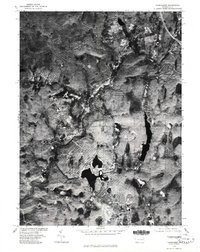
Other maps of this area

1889 · Scranton
USGS Topo · 1:62,500

1891 · Scranton
USGS Topo · 1:62,500

1893 · Scranton
USGS Topo · 1:62,500

1919 · Pocono
USGS Topo · 1:62,500

1921 · Pocono
USGS Topo · 1:62,500

1922 · Stoddartsville
USGS Topo · 1:62,500

1923 · Pocono
USGS Topo · 1:62,500

1924 · Stoddartsville
USGS Topo · 1:62,500

1928 · Ariel
USGS Topo · 1:62,500

1932 · Ariel
USGS Topo · 1:62,500
Featured Places
- Clifton Township, PA
- Thornhurst Township, PA
- Buck Township, PA
- Tobyhanna Township, PA
- Lehigh Township, PA