
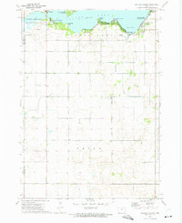
1972 Map of Thornton
USGS Topo · Published 1975About this map
Thornton and Meservey anchor this North Central Iowa landscape, which showcases a meticulously engineered agricultural environment in the early 1970s. The region is defined by its drainage and transport network, notably the Chicago and North Western railroad which cuts diagonally through the townships of Grimes and Wisner. The presence of Ditch No 70 and the channelization of Bailey Creek illustrate the era's focus on land reclamation and farm productivity in the rich soils of Pleasant Valley. Local history is preserved at the Pleasant View Cem north of Thornton, while the small settlement of Lindon appears as a quiet waypoint in the northwest. This survey also records recreational and civic spaces, including a Golf Course and a public Park at the heart of the local communities.
Find a feature on this map
21 named features on this map. Tap any name to fly to it.
Don’t see what you’re looking for? This feature index may not catch every label — zoom into the map to look around manually.
Map Details
Editions of this 1972 Thornton Map
This is the sole edition of this map. No revisions or reprints were ever made.
Other maps of this area

1954 · Mason City
USGS Topo · 1:250,000

1954 · Waterloo
USGS Topo · 1:250,000

1955 · Waterloo
USGS Topo · 1:250,000

1957 · Mason City
USGS Topo · 1:250,000

1958 · Mason City
USGS Topo · 1:250,000

1972 · Alexander
USGS Topo · 1:24,000

1972 · Swaledale
USGS Topo · 1:24,000

1972 · Burchinal
USGS Topo · 1:24,000

1972 · Belmond
USGS Topo · 1:24,000
1972 · Ventura Heights
USGS Topo · 1:24,000