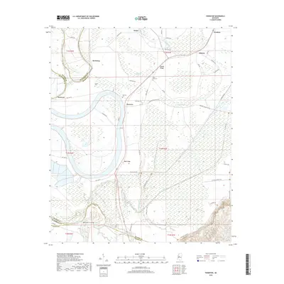
2018 Map of Thornton
USGS Topo · Published 2018About this map
The Yazoo River and the sweeping oxbow of Bee Lake define the bottomland character of this Mississippi Delta landscape. Small communities and family centers such as Thornton, Good Hope, and Mileston are interconnected by a dense network of local roads including Thornton Tollarville Rd and Epps Rd. The map illustrates the agricultural drainage system typical of the region, featuring Tipton Bayou and the Black Cr Ditch, while numerous landmarks like Good Hope Cem and Thornton Cem offer specific points of interest for genealogists tracing local families. To the south, the Belle Prairie Cut-Off and Tesheva Creek mark the transition toward the Holmes and Yazoo County line, reflecting the complex hydrology of the Yazoo basin prior to modern land-use changes.
Find a feature on this map
58 named features on this map. Tap any name to fly to it.
Don’t see what you’re looking for? This feature index may not catch every label — zoom into the map to look around manually.
Map Details
Editions of this 2018 Thornton Map
This is the sole edition of this map. No revisions or reprints were ever made.
Other maps of this area

1940 · Lexington
USGS Topo · 1:62,500

1940 · Mileston
USGS Topo · 1:62,500

1953 · Greenwood
USGS Topo · 1:250,000

1954 · Mileston
USGS Topo · 1:62,500

1955 · Jackson
USGS Topo · 1:250,000

1956 · Greenwood
USGS Topo · 1:250,000

1957 · Lexington
USGS Topo · 1:62,500

1958 · Lexington
USGS Topo · 1:62,500

1961 · Jackson
USGS Topo · 1:250,000

1961 · Valley
USGS Topo · 1:62,500