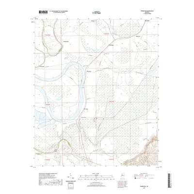
2020 Map of Thornton
USGS Topo · Published 2020About this map
Thornton and the surrounding Delta lowlands are defined by a complex network of oxbow lakes and winding bayous at the intersection of Holmes, Humphreys, and Yazoo counties. In this 2020 edition, the landscape remains dominated by seasonal wetlands and agricultural corridors, where Bee Lake and Tchula Lake frame the western reaches of the survey. The community of Mileston sits in the northeast, connected to Good Hope by a grid of rural roads such as Quafaloma Rd and Epps Rd.
Find a feature on this map
61 named features on this map. Tap any name to fly to it.
Don’t see what you’re looking for? This feature index may not catch every label — zoom into the map to look around manually.
Map Details
Editions of this 2020 Thornton Map
This is the sole edition of this map. No revisions or reprints were ever made.
Other maps of this area

1940 · Lexington
USGS Topo · 1:62,500

1940 · Mileston
USGS Topo · 1:62,500

1953 · Greenwood
USGS Topo · 1:250,000

1954 · Mileston
USGS Topo · 1:62,500

1955 · Jackson
USGS Topo · 1:250,000

1956 · Greenwood
USGS Topo · 1:250,000

1957 · Lexington
USGS Topo · 1:62,500

1958 · Lexington
USGS Topo · 1:62,500

1961 · Jackson
USGS Topo · 1:250,000

1961 · Valley
USGS Topo · 1:62,500