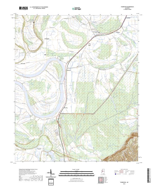
2024 Map of Thornton
USGS Topo · Published 2024About this map
Hillside National Wildlife Refuge and the Theodore Roosevelt National Wildlife Refuge dominate the southern half of this landscape, where the Yazoo River basin's complex hydrology is on full display. The area is defined by oxbow lakes and winding waterways like Bee Lake, Tchula Lake, and Horseshoe Brake, reflecting the historical movement of the river through the Delta. Cultural life is anchored by small settlements and rural congregations, including Good Hope and Quofaloma, with several church-affiliated burial grounds such as the Refuge Chapel Missionary Baptist Church Cem and Good Hope Baptist Church Cem serving as significant markers for local genealogy. The map traces the transition from these watery bottomlands to the rising bluffs near Yellow Bluff Rd in the southeast, capturing a specialized environment where managed wildlife habitats coexist with historic plantation lands and family landmarks like Brooks Cem and Thornton Cem.
Find a feature on this map
62 named features on this map. Tap any name to fly to it.
Don’t see what you’re looking for? This feature index may not catch every label — zoom into the map to look around manually.
Map Details
Editions of this 2024 Thornton Map
This is the sole edition of this map. No revisions or reprints were ever made.
Other maps of this area

1940 · Lexington
USGS Topo · 1:62,500

1940 · Mileston
USGS Topo · 1:62,500

1953 · Greenwood
USGS Topo · 1:250,000

1954 · Mileston
USGS Topo · 1:62,500

1955 · Jackson
USGS Topo · 1:250,000

1956 · Greenwood
USGS Topo · 1:250,000

1957 · Lexington
USGS Topo · 1:62,500

1958 · Lexington
USGS Topo · 1:62,500

1961 · Jackson
USGS Topo · 1:250,000

1961 · Valley
USGS Topo · 1:62,500