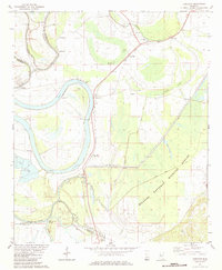
1982 Map of Thornton
USGS Topo · Published 1984About this map
The Illinois Central Gulf railroad defines the north-south corridor of this Mississippi Delta landscape, connecting agricultural settlements like Thornton and Mileston. This 1982 survey captures a transition between the cultivated floodplains and the preserved wetlands of the Hillside National Wildlife Refuge. The terrain is marked by the sinuous remnants of old river paths, including the massive oxbow of Bee Lake and the smaller Horseshoe Lake.
Find a feature on this map
36 named features on this map. Tap any name to fly to it.
Don’t see what you’re looking for? This feature index may not catch every label — zoom into the map to look around manually.
Map Details
Editions of this 1982 Thornton Map
This is the sole edition of this map. No revisions or reprints were ever made.
Other maps of this area

1940 · Lexington
USGS Topo · 1:62,500

1940 · Mileston
USGS Topo · 1:62,500

1953 · Greenwood
USGS Topo · 1:250,000

1954 · Mileston
USGS Topo · 1:62,500

1955 · Jackson
USGS Topo · 1:250,000

1956 · Greenwood
USGS Topo · 1:250,000

1957 · Lexington
USGS Topo · 1:62,500

1958 · Lexington
USGS Topo · 1:62,500

1961 · Jackson
USGS Topo · 1:250,000

1961 · Valley
USGS Topo · 1:62,500