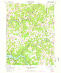
1958 Map of Thornton
USGS Topo · Published 1977About this map
The Tygart Valley River and the winding Baltimore and Ohio railroad corridor define the geography of Taylor County in the mid-20th century. This area is characterized by rural coal and clay extraction, evident in the numerous strip mines, kilns, and a clay pit located near Thornton. The settlement pattern follows the narrow valleys and ridges, with established communities like Blueville, Knottsville, and Evansville serving as local hubs.
Find a feature on this map
64 named features on this map. Tap any name to fly to it.
Don’t see what you’re looking for? This feature index may not catch every label — zoom into the map to look around manually.
Map Details
Editions of this 1958 Thornton Map
4 editions found
Other maps of this area

1886 · St. George
USGS Topo · 1:125,000

1891 · St. George
USGS Topo · 1:125,000

1902 · Fairmont
USGS Topo · 1:62,500

1904 · Philippi
USGS Topo · 1:62,500

1907 · Thornton
USGS Topo · 1:62,500

1907 · Belington
USGS Topo · 1:62,500

1923 · Fairmont
USGS Topo · 1:62,500

1925 · Philippi
USGS Topo · 1:62,500

1926 · Fairmont
USGS Topo · 1:62,500

1926 · Thornton
USGS Topo · 1:62,500