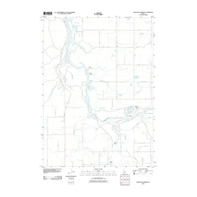
2010 Map of Thousand Springs
USGS Topo · Published 2010About this map
Thousand Springs and the canyon walls of the Snake River dominate this 2010 topographic study of Twin Falls County. The geography is defined by a complex hydraulic network where groundwater emerges from the basalt cliffs, supporting the Thousand Springs Powerplant and industrial sites like the Snake River Fish Hatchery. The map documents a specialized agricultural and aquaculture economy, with the small community of West Point situated on the plateau above the river's deep incisions. Landmarks such as Box Canyon, Blind Canyon, and the dramatic Devils Washboard Falls illustrate the erosional force of the water system. Along the river, named springs like Blue Heart Springs, Banbury Springs, and Hot Sulphur Springs indicate the geothermal and artesian activity common to this stretch of the Snake River Plain. The survey also tracks the roads that navigate the sheer elevation changes, including the Thousand Springs Grade and Clear Lakes Grade.
Find a feature on this map
62 named features on this map. Tap any name to fly to it.
Don’t see what you’re looking for? This feature index may not catch every label — zoom into the map to look around manually.
Map Details
Editions of this 2010 Thousand Springs Map
This is the sole edition of this map. No revisions or reprints were ever made.
Other maps of this area

1949 · Thousand Springs
USGS Topo · 1:24,000

1949 · Tuttle
USGS Topo · 1:24,000

1949 · Hagerman
USGS Topo · 1:24,000

1950 · Hagerman
USGS Topo · 1:24,000

1950 · Niagara Springs
USGS Topo · 1:24,000

1950 · Jerome
USGS Topo · 1:62,500

1951 · Thousand Springs
USGS Topo · 1:24,000

1951 · Tuttle
USGS Topo · 1:24,000

1951 · Clover
USGS Topo · 1:24,000

1954 · Thousand Springs
USGS Topo · 1:24,000