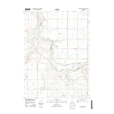
2013 Map of Thousand Springs
USGS Topo · Published 2013About this map
Thousand Springs and the surrounding high desert plateau define this region of Idaho's Snake River Plain. The landscape is marked by the unique hydrogeology of the area, where water emerges from the basalt canyon walls. The small settlement of West Point serves as a local landmark amidst a grid of agricultural development and water management features. Sand Springs further illustrates the critical role of groundwater in this arid environment during the early 21st century. The map reflects a modern era of land use where irrigation and natural springs coexist, shaping the development of rural Twin Falls County.
Find a feature on this map
3 named features on this map. Tap any name to fly to it.
Don’t see what you’re looking for? This feature index may not catch every label — zoom into the map to look around manually.
Map Details
Editions of this 2013 Thousand Springs Map
This is the sole edition of this map. No revisions or reprints were ever made.
Other maps of this area

1949 · Thousand Springs
USGS Topo · 1:24,000

1949 · Tuttle
USGS Topo · 1:24,000

1949 · Hagerman
USGS Topo · 1:24,000

1950 · Hagerman
USGS Topo · 1:24,000

1950 · Niagara Springs
USGS Topo · 1:24,000

1950 · Jerome
USGS Topo · 1:62,500

1951 · Thousand Springs
USGS Topo · 1:24,000

1951 · Tuttle
USGS Topo · 1:24,000

1951 · Clover
USGS Topo · 1:24,000

1954 · Thousand Springs
USGS Topo · 1:24,000