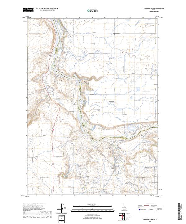
2023 Map of Thousand Springs
USGS Topo · Published 2023About this map
Thousand Springs and the complex hydrogeology of the Magic Valley are meticulously charted where the Snake River carves through the basaltic canyon. This 2023 survey illustrates the convergence of groundwater and surface water, with prominent features like Box Canyon and Blind Canyon cutting into the canyon rim. The river is a focal point for both energy and recreation, marked by the churning waters of Kanaka Rapids and the dramatic drop of Devils Washbowl Falls.
Find a feature on this map
82 named features on this map. Tap any name to fly to it.
Don’t see what you’re looking for? This feature index may not catch every label — zoom into the map to look around manually.
Map Details
Editions of this 2023 Thousand Springs Map
This is the sole edition of this map. No revisions or reprints were ever made.
Other maps of this area

1949 · Thousand Springs
USGS Topo · 1:24,000

1949 · Tuttle
USGS Topo · 1:24,000

1949 · Hagerman
USGS Topo · 1:24,000

1950 · Hagerman
USGS Topo · 1:24,000

1950 · Niagara Springs
USGS Topo · 1:24,000

1950 · Jerome
USGS Topo · 1:62,500

1951 · Thousand Springs
USGS Topo · 1:24,000

1951 · Tuttle
USGS Topo · 1:24,000

1951 · Clover
USGS Topo · 1:24,000

1954 · Thousand Springs
USGS Topo · 1:24,000