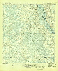
1945 Map of Thousand Yard Bay
USGS Topo · Published 1945About this map
Apalachicola National Forest dominates this 1945 landscape, characterized by the intricate drainage systems and wetland basins of the Florida Panhandle. The Ochlockonee River snakes along the eastern boundary, carving a complex path through the lowlands where features like Silver Slough and the Thousand Yard Bay define the hydrology of the region. The interior is a web of named waterways, including Bevell Branch and Vause Branch, reflecting a landscape defined more by its water than by its roads.
Find a feature on this map
16 named features on this map. Tap any name to fly to it.
Don’t see what you’re looking for? This feature index may not catch every label — zoom into the map to look around manually.
Map Details
Editions of this 1945 Thousand Yard Bay Map
3 editions found
Other maps of this area

1944 · Pickett Bay
USGS Topo · 1:31,680

1944 · Queens Bay
USGS Topo · 1:24,000

1945 · Thousand Yard Bay
USGS Topo · 1:31,680

1945 · Smith Creek
USGS Topo · 1:31,680

1945 · Bradwell Bay
USGS Topo · 1:31,680

1945 · Tates Hell Swamp
USGS Topo · 1:31,680

1945 · Mc Intyre
USGS Topo · 1:31,680

1945 · Pickett Bay
USGS Topo · 1:31,680

1945 · Sanborn
USGS Topo · 1:31,680

1946 · Queens Bay
USGS Topo · 1:31,680