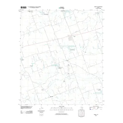
2010 Map of Thrall
USGS Topo · Published 2010About this map
Thrall and the surrounding Williamson County blacklands appear as a landscape defined by petroleum extraction and water management in the early twenty-first century. This survey documents the Thrall Oil Field, Noack Oil Field, and Beyersville Oil Field, illustrating the ongoing significance of the local oil industry alongside traditional agricultural settlements like Beyersville and Noack. Numerous Soil Conservation Service projects, including the Soil Conservation Service Site 33 Reservoir and the Soil Conservation Service Site 18 Reservoir, show the extensive network of dams and reservoirs built to manage the drainage of Mustang Creek and Brushy Creek. For genealogists, the map preserves the location of several burial grounds, including Christ Church Cemetery, the Wuthrich Hill Cemetery near Wuthrich Hill, and the Beyersville Cemetery, which serve as anchors for these long-standing rural communities.
Find a feature on this map
65 named features on this map. Tap any name to fly to it.
Don’t see what you’re looking for? This feature index may not catch every label — zoom into the map to look around manually.
Map Details
Editions of this 2010 Thrall Map
This is the sole edition of this map. No revisions or reprints were ever made.
Other maps of this area

1885 · Taylor
USGS Topo · 1:125,000

1885 · Bastrop
USGS Topo · 1:125,000

1887 · Taylor
USGS Topo · 1:125,000

1893 · Bastrop
USGS Topo · 1:125,000

1894 · Taylor
USGS Topo · 1:125,000

1904 · Bastrop
USGS Topo · 1:125,000

1948 · Elgin
USGS Topo · 1:62,500

1948 · Lexington
USGS Topo · 1:62,500

1950 · Lexington
USGS Topo · 1:62,500

1950 · Elgin
USGS Topo · 1:62,500