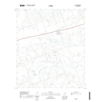
2019 Map of Thrall
USGS Topo · Published 2019About this map
Thrall serves as the primary hub of this Williamson County landscape, where the intersection of W Taylor St and Main St anchors a community defined by its proximity to both rail lines and fertile agricultural drainage. The topography is intricately carved by an extensive network of waterways, including the winding course of Mustang Cr and the confluence of Little Dry Brushy Cr with Brushy Cr.
Find a feature on this map
62 named features on this map. Tap any name to fly to it.
Don’t see what you’re looking for? This feature index may not catch every label — zoom into the map to look around manually.
Map Details
Editions of this 2019 Thrall Map
This is the sole edition of this map. No revisions or reprints were ever made.
Other maps of this area

1885 · Taylor
USGS Topo · 1:125,000

1885 · Bastrop
USGS Topo · 1:125,000

1887 · Taylor
USGS Topo · 1:125,000

1893 · Bastrop
USGS Topo · 1:125,000

1894 · Taylor
USGS Topo · 1:125,000

1904 · Bastrop
USGS Topo · 1:125,000

1948 · Elgin
USGS Topo · 1:62,500

1948 · Lexington
USGS Topo · 1:62,500

1950 · Lexington
USGS Topo · 1:62,500

1950 · Elgin
USGS Topo · 1:62,500