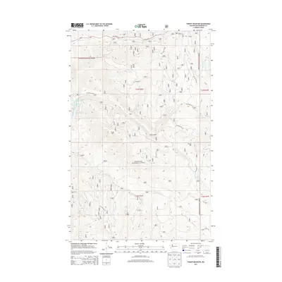
2014 Map of Thrapp Mountain
USGS Topo · Published 2014About this map
Okanogan National Forest encompasses this high-elevation landscape, where a series of mountain peaks and ridges define the drainage patterns of the Pacific Northwest. Prominent elevations such as Pole Pick Mtn, Thrapp Mtn, and Finley Mtn overlook a network of seasonal and perennial waters. The Wenner Lakes group, including Wenner Lakes Number Two, Wenner Lakes Number Three, and Wenner Lake Number Five, sits tucked into the western slopes. Access to this backcountry is provided by an extensive system of forest roads, including Nat For Dev Rd 600 and Nat For Dev Rd 300, which navigate the steep descent into Finley Canyon. In the southern portion of the sheet, the terrain transitions at Jay Ridge toward the waters of S Fork Benson Cr and Yockey Cr.
Find a feature on this map
29 named features on this map. Tap any name to fly to it.
Don’t see what you’re looking for? This feature index may not catch every label — zoom into the map to look around manually.
Map Details
Editions of this 2014 Thrapp Mountain Map
This is the sole edition of this map. No revisions or reprints were ever made.
Other maps of this area

1899 · Methow
USGS Topo · 1:125,000

1901 · Methow
USGS Topo · 1:125,000

1905 · Okanogan
USGS Topo · 1:125,000

1954 · Okanogan
USGS Topo · 1:250,000

1955 · Concrete
USGS Topo · 1:250,000

1956 · Loup Loup
USGS Topo · 1:62,500

1957 · Brewster
USGS Topo · 1:62,500

1958 · Concrete
USGS Topo · 1:250,000

1958 · Okanogan
USGS Topo · 1:250,000

1962 · Concrete
USGS Topo · 1:250,000