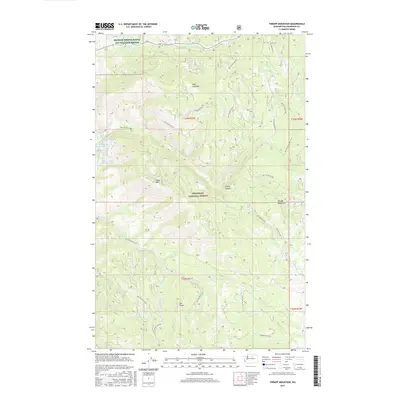
2017 Map of Thrapp Mountain
USGS Topo · Published 2017About this map
The Okanogan National Forest dominates this high-elevation landscape, where the peaks of Thrapp Mountain and Pole Pick Mtn overlook a complex network of forest development roads. This 2017 study illustrates the remote character of Washington's northern interior, showing the protected habitats of the Methow Winter Range and Wildlife Refuge near Frazer Cr. The drainage patterns here are well-defined by numerous seasonal and perennial flows, including Hooker Cr, Chilliwist Cr, and the S Fork Benson Cr. Notable landmarks such as Jay Ridge and the series of small alpine waters known as Wenner Lakes provide essential orientation points for those navigating the transition between Finley Mtn and the depths of Finley Canyon. The dominance of forest service infrastructure suggests an area primarily managed for timber, wildlife preservation, and watershed protection.
Find a feature on this map
34 named features on this map. Tap any name to fly to it.
Don’t see what you’re looking for? This feature index may not catch every label — zoom into the map to look around manually.
Map Details
Editions of this 2017 Thrapp Mountain Map
This is the sole edition of this map. No revisions or reprints were ever made.
Other maps of this area

1899 · Methow
USGS Topo · 1:125,000

1901 · Methow
USGS Topo · 1:125,000

1905 · Okanogan
USGS Topo · 1:125,000

1954 · Okanogan
USGS Topo · 1:250,000

1955 · Concrete
USGS Topo · 1:250,000

1956 · Loup Loup
USGS Topo · 1:62,500

1957 · Brewster
USGS Topo · 1:62,500

1958 · Concrete
USGS Topo · 1:250,000

1958 · Okanogan
USGS Topo · 1:250,000

1962 · Concrete
USGS Topo · 1:250,000