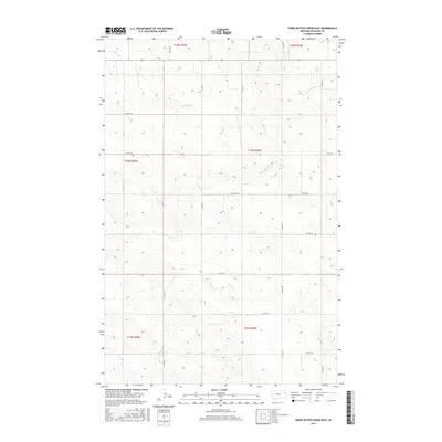
2017 Map of Three Buttes Creek East
USGS Topo · Published 2017About this map
E Charlie Cr and its tributaries carve a network of drainages through the eastern Montana landscape of Richland County, as shown in this 2017 survey. The terrain is defined by a grid-like system of section lines and gravel routes, including north-south corridors like Co Rd 332 and Co Rd 331 that intersect with east-west connectors such as Co Rd 132. These roads trace the high ground and slopes between several named waterways, including Timber Cr and Cheney Cr.
Find a feature on this map
22 named features on this map. Tap any name to fly to it.
Don’t see what you’re looking for? This feature index may not catch every label — zoom into the map to look around manually.
Map Details
Editions of this 2017 Three Buttes Creek East Map
This is the sole edition of this map. No revisions or reprints were ever made.
Other maps of this area

1909 · Glendive
USGS Topo · 1:250,000

1954 · Glendive
USGS Topo · 1:250,000

1957 · Glendive
USGS Topo · 1:250,000

1958 · Glendive
USGS Topo · 1:250,000

1966 · Crane NW
USGS Topo · 1:24,000

1972 · Girard
USGS Topo · 1:24,000
1972 · Blue Hill
USGS Topo · 1:24,000

1972 · Fox Lake
USGS Topo · 1:24,000

1972 · Lambert
USGS Topo · 1:24,000

1981 · Sidney
USGS Topo · 1:100,000