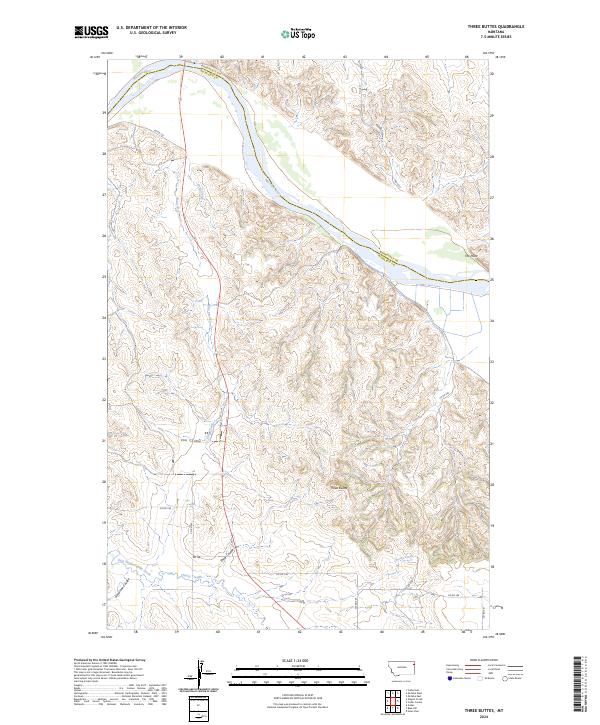
2024 Map of Three Buttes
USGS Topo · Published 2024About this map
The Missouri River serves as the dominant natural boundary on this Montana landscape, carving a wide path along the northern reaches where Roosevelt Co and Richland Co meet. The terrain south of the river is characterized by a complex network of drainages and upland features, including the distinct elevation of Three Buttes and the landform known as The Point. These geographic markers provided essential orientation for early travel and ranching in the region.
Find a feature on this map
23 named features on this map. Tap any name to fly to it.
Don’t see what you’re looking for? This feature index may not catch every label — zoom into the map to look around manually.
Map Details
Editions of this 2024 Three Buttes Map
This is the sole edition of this map. No revisions or reprints were ever made.
Other maps of this area

1909 · Glendive
USGS Topo · 1:250,000

1954 · Glendive
USGS Topo · 1:250,000

1954 · Wolf Point
USGS Topo · 1:250,000

1957 · Glendive
USGS Topo · 1:250,000

1958 · Wolf Point
USGS Topo · 1:250,000

1958 · Glendive
USGS Topo · 1:250,000

1969 · Cedar Coulee
USGS Topo · 1:24,000
1969 · Culbertson
USGS Topo · 1:24,000

1969 · Three Buttes
USGS Topo · 1:24,000

1969 · Dugout Creek
USGS Topo · 1:24,000