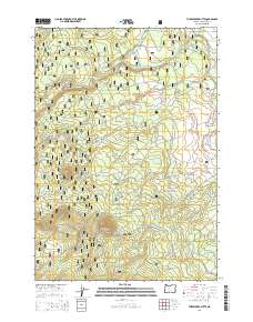
2014 Map of Three Creek Butte
USGS Topo · Published 2014About this map
Deschutes National Forest encompasses the entirety of this high-desert landscape in central Oregon, defined by volcanic landmarks and complex water management. The prominent cinder cones of Three Creek Butte and Melvin Butte dominate the local topography, marking the eastern edge of the Cascade Range. This 2014 survey documents the intricate network of forest development roads and logging infrastructure, such as the B-5 Logging Rd and Nat For Dev Rd 1610, which crisscross the timberlands. Water distribution is a central theme of the map, illustrating how historical irrigation systems like Smith Ditch, Maxwell Ditch, and Snow Cr Ditch divert flows from Whychus Creek to support the arid region. The presence of Black Pine Spring and Melvin Spring provides critical natural water points amidst the forest's extensive road network and seasonal drainages like Brush Draw.
Find a feature on this map
32 named features on this map. Tap any name to fly to it.
Don’t see what you’re looking for? This feature index may not catch every label — zoom into the map to look around manually.
Map Details
Editions of this 2014 Three Creek Butte Map
This is the sole edition of this map. No revisions or reprints were ever made.
Other maps of this area

1926 · Bend
USGS Topo · 1:125,000

1929 · Bend
USGS Topo · 1:125,000

1929 · Three Sisters
USGS Topo · 1:125,000

1932 · Three Sisters
USGS Topo · 1:125,000

1955 · Bend
USGS Topo · 1:250,000

1957 · Bend
USGS Topo · 1:250,000

1958 · Bend
USGS Topo · 1:250,000

1959 · Broken Top
USGS Topo · 1:62,500

1959 · Sisters
USGS Topo · 1:62,500
1962 · Henkle Butte
USGS Topo · 1:24,000