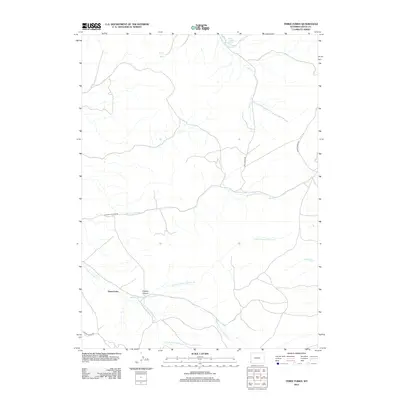
2012 Map of Three Forks
USGS Topo · Published 2012About this map
Three Forks sits at a convergence of drainages in Uinta County, where the landscape is defined by the complex hydrology of Whitney Canyon and the multiple branches of the Fowkes Canyon Cr system. The terrain is marked by significant spring activity, including School Section Spring in the north and Grove Spring further east, which historically provided vital water sources in this arid region of Wyoming. The network of canyons is articulated through detailed drainage patterns, such as the N Fork Fowkes Canyon Cr and S Fork Fowkes Canyon Cr. Access through this high-country terrain follows established routes like Whitney Canyon Rd and Salt Creek Rd, tracing the natural paths carved by Salt Cr and other local waterways. This map provides a clear view of the topographical relationship between these canyons and the early 21st-century road network that connects them.
Find a feature on this map
18 named features on this map. Tap any name to fly to it.
Don’t see what you’re looking for? This feature index may not catch every label — zoom into the map to look around manually.
Map Details
Editions of this 2012 Three Forks Map
This is the sole edition of this map. No revisions or reprints were ever made.
Other maps of this area

1912 · Randolph
USGS Topo · 1:125,000

1954 · Ogden
USGS Topo · 1:250,000

1958 · Ogden
USGS Topo · 1:250,000

1960 · Ogden
USGS Topo · 1:250,000

1962 · Sawtooth Mountain
USGS Topo · 1:24,000

1962 · Bell Butte
USGS Topo · 1:24,000

1965 · Evanston
USGS Topo · 1:24,000

1965 · Little Dee Creek
USGS Topo · 1:24,000

1965 · Guild Hollow
USGS Topo · 1:24,000

1965 · Three Forks
USGS Topo · 1:24,000